World-first science course at MAC
22 October 2024, 4:04 PM
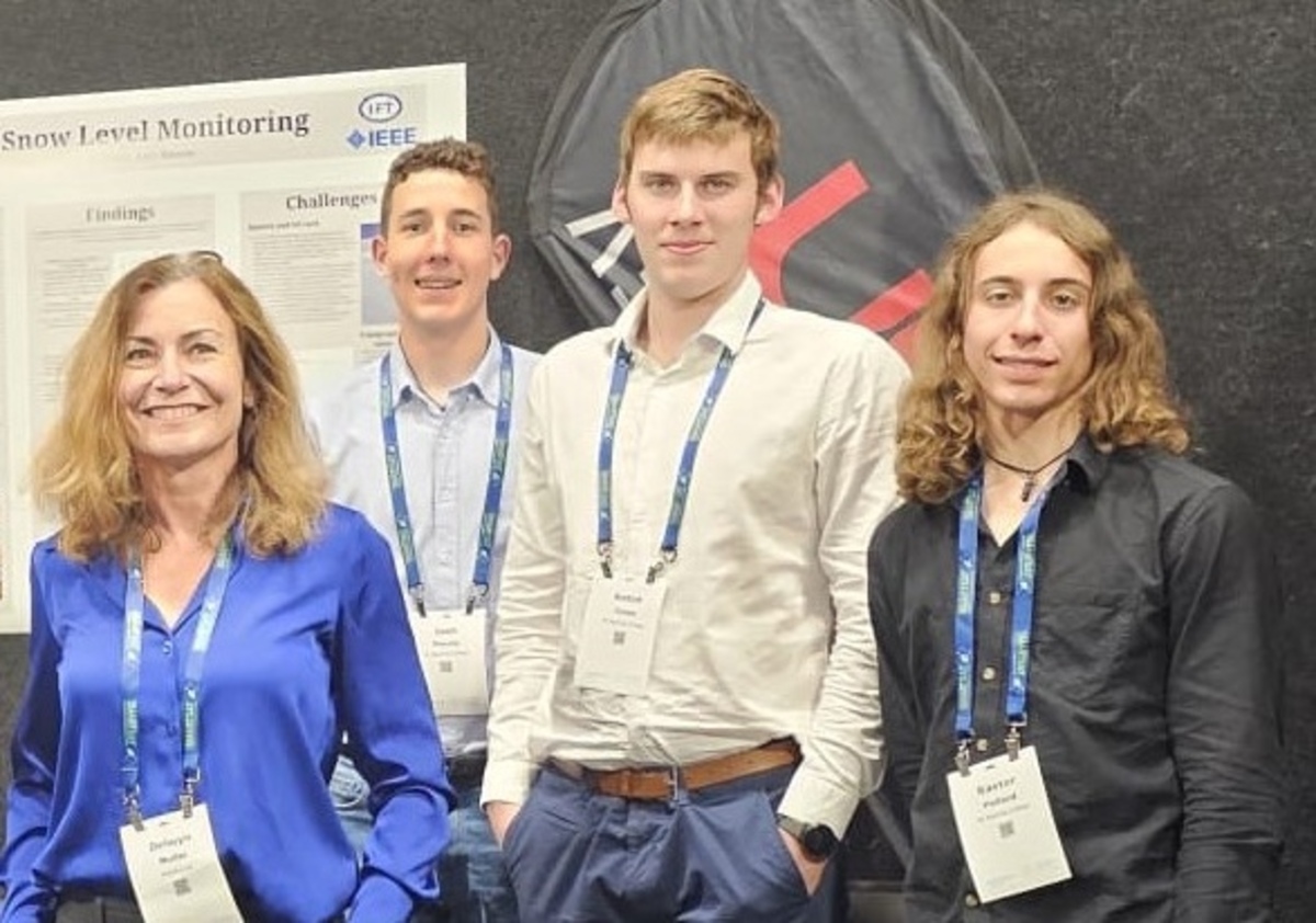 (From left) Dr Delwyn Moller with students Josh Moody, Anton Jones and Baxter Pollard at the New Zealand Aerospace Summit.
A group of Te Kura o Tititea Mt Aspiring College (MAC) year 13 students is undertaking a world-first, university-level science course combining physics, electronics and computer skills.
Year 13 students Amy Benson, Anton Jones, Josh Moody, and Baxter Pollard are researching how GPS signals can be used to monitor properties of the earth’s environment.
This is the first time the Geoscience and Remote Sensing Society (GRSS), one of the 39 societies of the global Institute of Electrical and Electronics Engineers (IEEE), has sponsored a course for high school students.
GRSS New Zealand Chapter chair Dr Delwyn Moller said the course met the needs of students who had completed Year 13 physics in Year 12 and were interested in taking university-level coursework during their final year at school.
“We worked with MAC teachers Euan Simpson (physics) and Craig Jefferies (technology) to craft a proposal to the IEEE GRSS to sponsor this new course,” Delwyn said.
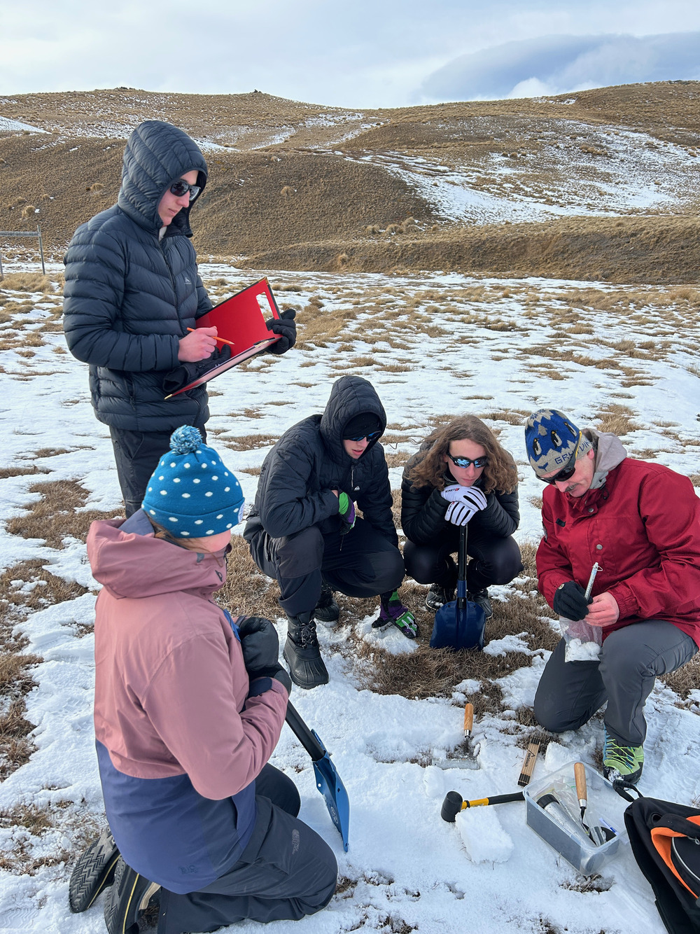
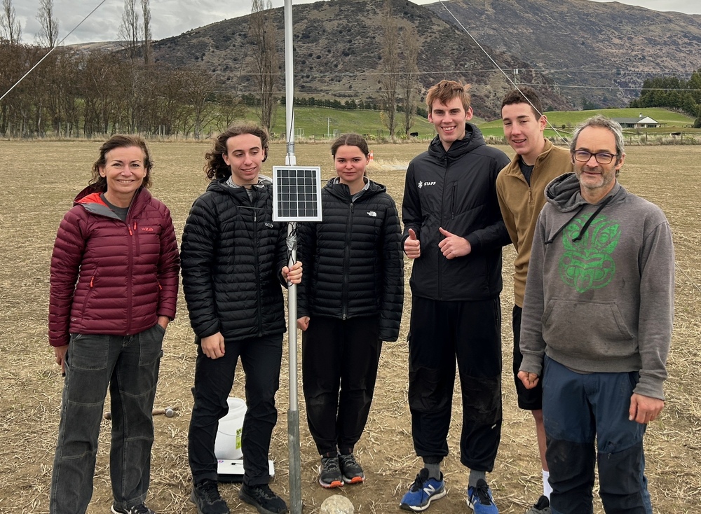
Undertaking fieldwork: students (from left) Amy Benson, Josh Moody, Anton Jones, Baxter Pollard, and Director of Gateway Antarctica at the University of Canterbury Professor Wolfgang Rack.
“The GRSS was immediately supportive of the concept and is watching the outcomes of the course with interest.
“The course involves creating ground validation sites for the world’s scientists so they can use it to monitor GPS-reflected signals to better understand our environment. We hope it will serve as a prototype for students worldwide.”
Student Baxter Pollard said the course provided challenges that were bigger than any other problems he had worked on throughout his education.
“This project involves physics, coding, electronics, mechanical design, and implementation, and has shown us how reflected GPS signals can be used to measure lake height, soil moisture, and snow height,” he said.
“Through this course, I have learned very good debugging skills because not everything has worked as designed, and this has been a great lesson to me.”
The project has drawn support from Snow Farm NZ which agreed to host a GPS station, and ReSTORe Lab, a Wānaka-based company that focuses on the development of new, advanced remote sensing methods for monitoring the earth.
(From left) Dr Delwyn Moller with students Baxter Pollard, Amy Benson, Anton Jones and Josh Moody, and technology teacher Craig Jefferies.
ReSTORe Lab also leads the Rongowai project, a collaboration with NASA and Air New Zealand to use GPS receivers to monitor environmental properties from an Air New Zealand aircraft (the same technology being used by the students) with both projects aiming to advance earth observations.
The four MAC students attended the New Zealand Aerospace Summit in Christchurch last month to present their findings as part of the University of Canterbury exhibit at the event.
Following completion of this year’s pilot, MAC will continue to offer the course, with the aim of expanding the project to include multiple GPS sites at Snow Farm and elsewhere in the region.
PHOTOS: MAC