Wet, windy and warm weather ahead
27 July 2025, 1:28 AM
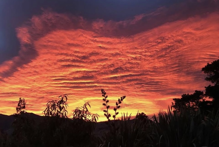 Red sunrises indicate “a more active and changeable weather week”.
The MetService says more widespread wet weather is expected early this coming week, and local skifields are bracing for rain rather than the hoped-for snow.
The country has enjoyed a run of calm, frosty mornings and crisp, clear days under a broad ridge of high pressure.
Wānaka dipped to its lowest temperatures of the year late last Thursday (July 24) at -5.1°C.
“However, this spell of settled weather is coming to a close, as conditions gradually turn over the weekend with warmer temperatures, rain and wind firmly returning to the forecast from early next week,” MetService meteorologist Devlin Lynden said.
“After what has been a notably cold and settled week of July, the shift to a more active pattern may feel like a dramatic change for many.
“We can enjoy the clear days for a little bit longer. But that ridge is on the move.”
Devlin said the next system will bring rain and wind back into the picture for many areas by late today (Sunday July 27) and into Monday, “with more severe weather possible on Tuesday”.
This coming week looks “more unsettled overall”, with warmer temperatures brought in by strengthening northerly winds.
It will be “a more active and changeable weather week”, Devlin said.
PHOTO: Wānaka App