Snow in the forecast?

Sue Wards
24 August 2020, 6:15 PM
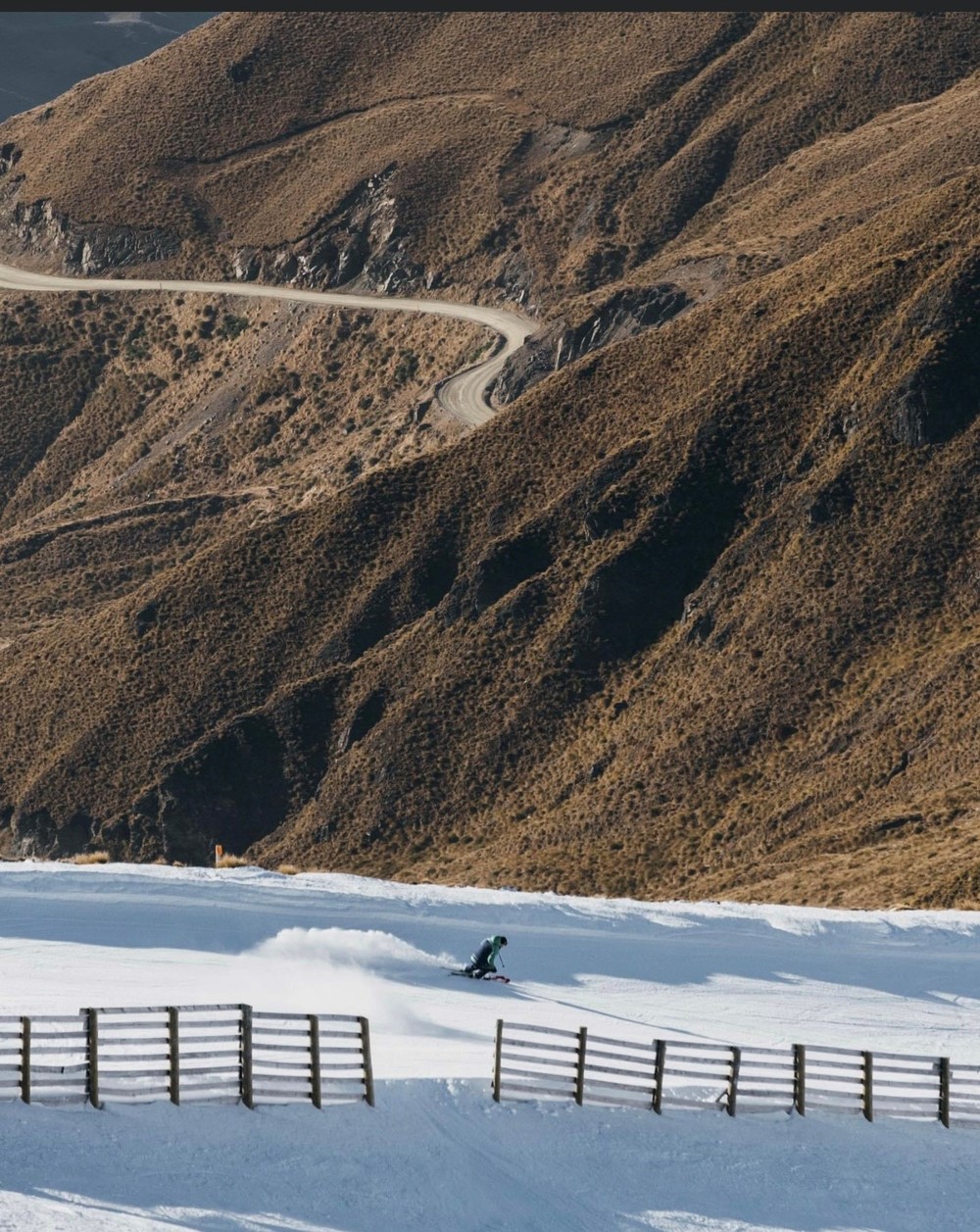
 Much needed snow falls at Cardrona Alpine Resort last week. PHOTO: Supplied
While there is officially only one week of winter left, spring-like weather and snow conditions have arrived too soon for most skiers.
Cardrona Alpine Resort yesterday (Monday August 24) reported spring-like conditions, after a dusting of snow overnight.

Treble Cone’s snow report yesterday was similar: “Spring like conditions across the mountain, we didn't have much of a freeze last night so conditions will be soft and skiable from early on.”
Snow Farm reported spring snow conditions and limited snow coverage.
Check out the Snow report in your Wanaka App
"The sustained warm temperatures and rain over the past two weeks have contributed to one of the lowest August snow bases on record," Snow Farm general manager Sam Lee said.
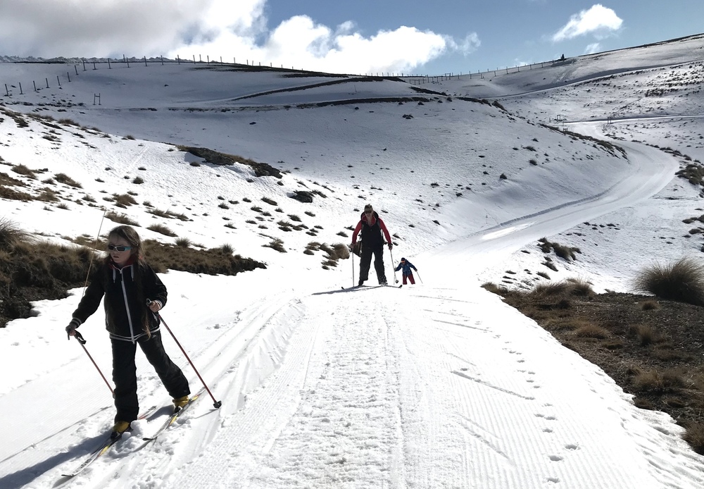
Treble Cone last week. PHOTO: Finlay Woods
Sam said the Snow Farm made the call on Saturday to postpone the annual Merino Muster, which was to be held this weekend, until September 12. The current snow levels are insufficient to safely run the event, and the skifield was optimistically giving itself two weeks to allow for additional snowfall, he said.
The Wanaka App spoke to NIWA meteorologist Seth Carrier to find out when snow is on the horizon.
The Snow Farm on Saturday PHOTO: Wanaka App
“In the short term it does look like there’s the chance for a little bit of snow during the day tomorrow (Tuesday August 25),” Seth said, but the snow is forecast for the middle of the day when temperatures are warmer, meaning any snow is unlikely to stay.
There may be a few centimetres on the skifields, he said, but “not anything that impressive”.
Forecasts indicate heavy snow on Friday, potentially bringing 40-50cm to local skifields, but Seth wasn’t so optimistic.
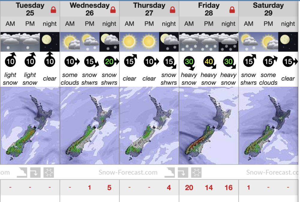
Snow-forecast.com says TC will get 50cm of snow on Friday
It is “very hit or miss forecasting snowfall”, he said, but ventured to say there could be a chance for snow on Saturday when the southerly front comes through, and possibly more snow early to mid next week.
However, Seth said the increasing trend to northerly and westerly winds means warmer weather, dry föhn winds, and a possible move to a La Niña weather pattern - which signals more northerly or easterly winds from the subtropics and a continuation of warmer than average temperatures.
“As we go through the remainder of the winter, any time we get a southerly change coming through that increases the chances of snow, but generally speaking we’re probably going to have a fair number of northerly winds,” Seth said.
“That southeasterly has been a bit hard to come by this winter. We’re seeing some small snowfalls but heavy snow is probably going to be unlikely.”