Deadline looms for controversial landscape proposals

Sue Wards, Editor
19 August 2022, 5:06 PM
 The Maungawera Valley has been designated a ‘rural character landscape’. PHOTO: Wānaka App
Rural landowners have one week left to submit feedback on a new district council policy which has caused controversy in other regions.
At the direction of the Environment Court, in June the Queenstown Lakes District Council (QLDC) publicly notified a variation to its Proposed District Plan proposing landscape schedules to assess applications for development resource consents.
The schedules caused an uproar when introduced on the West Coast, for example in instances where landholders were told iwi were able to identify places of “former cultural significance” on their land, restricting land use.
A QLDC spokesperson told the Wānaka App the schedules describe the values and elements of an area that people care about. They are used to assess resource consent applications and determine what development can be accommodated in the area without compromising these values and elements (which include cultural, historical, and biodiversity values).
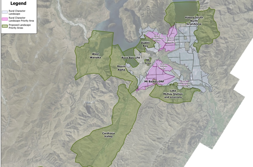
The entire Upper Clutha is a rural character landscape, with designated priority areas. IMAGE: Supplied
“There are no changes to the rules for development as part of this proposal.”
Read more: What do our landscapes mean to you?
However, Queenstown lawyer Graeme Todd told the Wānaka App that anyone who owns rural land in the district needs to be aware that the proposed schedules could restrict how landowners use their land.
He said the schedules “will be used by consent authorities (council and the courts) in ‘colouring’ their interpretation of the District Plan objectives and policies.
“It is vitally important that owners of land within the various landscapes who [aspire] to undertake activities, subdivide or develop their land familiarise themselves with what council is proposing,” Graeme said.
He said the schedules are intended to identify what the community and iwi value in respect of the landscapes, “but more importantly propose to quantify the capacity of individual identified landscapes for further development and activities whether they be farming or tourism activities, earthworks, farm buildings, or rural living or visitor accommodation activities”.
“In promoting the schedules the council has taken a very conservative view as to how little capacity landscapes have to accommodate various forms of development and activities.”
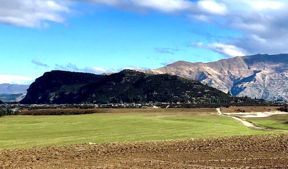
Outstanding natural feature: Mount Iron. PHOTO: Wānaka App
The schedules will affect land in the district already designated Outstanding Natural Landscapes or Features (ONLs and ONFs), but the QLDC has decided to also consider the entire Upper Clutha as ‘rural character landscape’.
Specific ONL and OFL areas have been given priority, such as Cardrona Valley, Lake McKay Station and environs, West Wānaka, Roys Bay, Mt Iron, Mt Alpha, Dublin Bay, Hāwea South and North Grandview and Mt Barker.
Rural character landscapes, including Cardona River/Mt Barker Road, Halliday Road, SH8A/Church Road Luggate, Maungawera Valley, and West of Hāwea River, are also prioritised.
Lake Hāwea farmer Richard Burdon told the Wānaka App he was frustrated by the council’s emphasis on landscape.
Richard said the council already has regulations in place for priority areas, and council must allow for businesses to grow and evolve.
“Where I live I don’t want to have all my property rights removed just so someone can look out the window,” he said.
Richard said it was ultimately up to the community to say whether these issues were priorities or not.
QLDC said the schedules were drafted with the help of experts with experience of the district and its District Plan rules, and will be introduced to the Proposed District Plan as a variation to Chapter 21 Rural Zone.
The move was formally notified on June 30, 2022, and submissions must be made by Friday August 26.
After submissions close, a summary of these will be prepared and publicly notified, providing a further opportunity for input from the public.
See the map showing the areas covered found here and find more information here and here.