Boost to Otago ground mapping project
05 January 2026, 4:04 PM
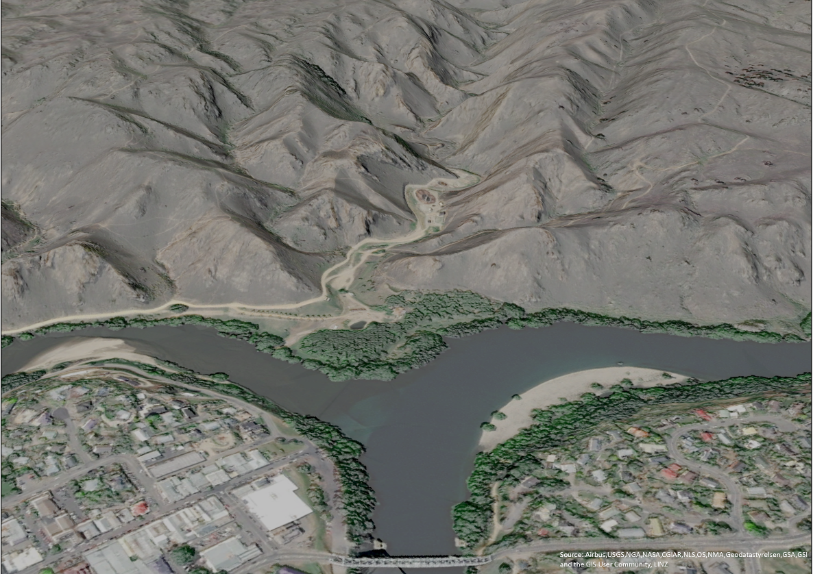 LiDAR imagery looking east at the confluence of the Manuherikia and Clutha River at Alexandra.
The Ministry for the Environment (MfE) is contributing $1.2M toward an Otago Regional Council (ORC) project to advance fly-over LiDAR (light detection and ranging) ground mapping coverage across the region.
LiDAR involves sending a beam of light from a device on a low-flying plane, which bounces back from the ground to give a measurement of land elevation. The technique is used to create elevation maps for large land areas.
ORC’s natural hazards spatial analyst Andrew Welsh said Otago and parts of Fiordland are the only regions without full LiDAR coverage, so MfE’s contribution is invaluable in helping achieve full coverage across Otago in the near future.
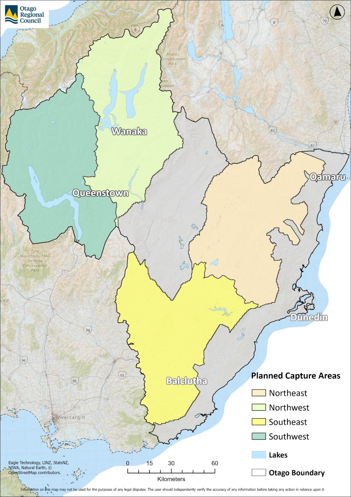
The map shows the four areas to be mapped, with the southwest quadrant (including Queenstown) to be captured first.
Presently there’s about 10,200 square kilometres (sq km) of existing LiDAR data over 28 percent of Otago, with coverage including Dunedin and Mosgiel, down the coast from the Waitaki River to the Catlins, in parts of the Central Otago and Queenstown Lakes districts, plus the Clutha and Waitaki rivers’ catchments.
“The new project and flyovers of four inland and the alpine lakes areas will collate a further 23,000sq km of data, or 72 percent of Otago,” Andrew said.
“Combined with the earlier flyover data, there’ll be 100 percent LiDAR coverage of the province; all eventually accessible to the public.
“The data LiDAR generates is invaluable in understanding and preparing for natural hazards, such as flooding, erosion or landslips, as well as assisting with infrastructure management, hydrology and catchment planning.”
The LiDAR mapping information will be made publicly available for anyone to use once it is captured and processed.
Otago and parts of Fiordland are the only regions in the country without full LiDAR coverage.
Andrew said flights have already begun around Otago’s southwest area, with the entire project expected to be completed over two to three years.
IMAGES: Supplied