At last - snow in the forecast
Tony O'Regan
19 September 2023, 5:00 PM
 Cardrona Alpine Resort will be hoping the forecast is correct with school holidays starting this Saturday (September 23).
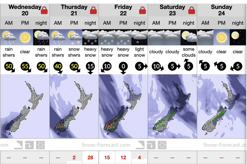
It may be a case of ‘believe it when we see it’ but a significant snowfall is forecast for this Thursday and Friday (September 21 and 22) with more than a metre of snow predicted for Treble Cone.
MetService says an active front will move onto the south of the South Island later this week with the possibility of heavy snow affecting higher parts of Otago.
Snow is forecast for as low as 1,300 metres late on Thursday and 1,000 metres on Friday.
The website snow-forecast is predicting 0.6 metres of snow at Cardrona Alpine Resort and 1.2 metres at Treble Cone.
Fine, cold weather and light winds are forecast for this weekend and early next week, which could make for some of the best skiing of the year if the snowfall eventuates.

As of Tuesday (September 19) the website snow-forecast was predicting 61 centimetres of snow for Cardrona Alpine Resort.
A snow dump would also be timely for local ski fields which have endured a difficult season due to the lack of snow.
Both Cardrona and Treble Cone had limited facilities open during the July school holidays.
A heavy snowfall this week would come just in time for the two-week September/October school holidays commencing this Saturday (September 23).
The Snow Farm announced on September 6 that it had closed for cross-country ski activities for the season due to unfavourable weather conditions.
Find the latest in Snow conditions in your Wānaka App.
PHOTO: Real NZ


